Land records once were a confusing tangle; no more. The government of Haryana, with the advent of digital systems, has simplified data related to land for the common man. And, one of the prime aspects of this digital transformation is the cadastral map Haryana system. These maps are accurate, easy to use, and publicly available.
The cadastral map shows detailed boundaries of land plots. It includes data like ownership, area, and direction. Whether you are a landowner, buyer, or planning to get a loan, these maps can help you in several ways.
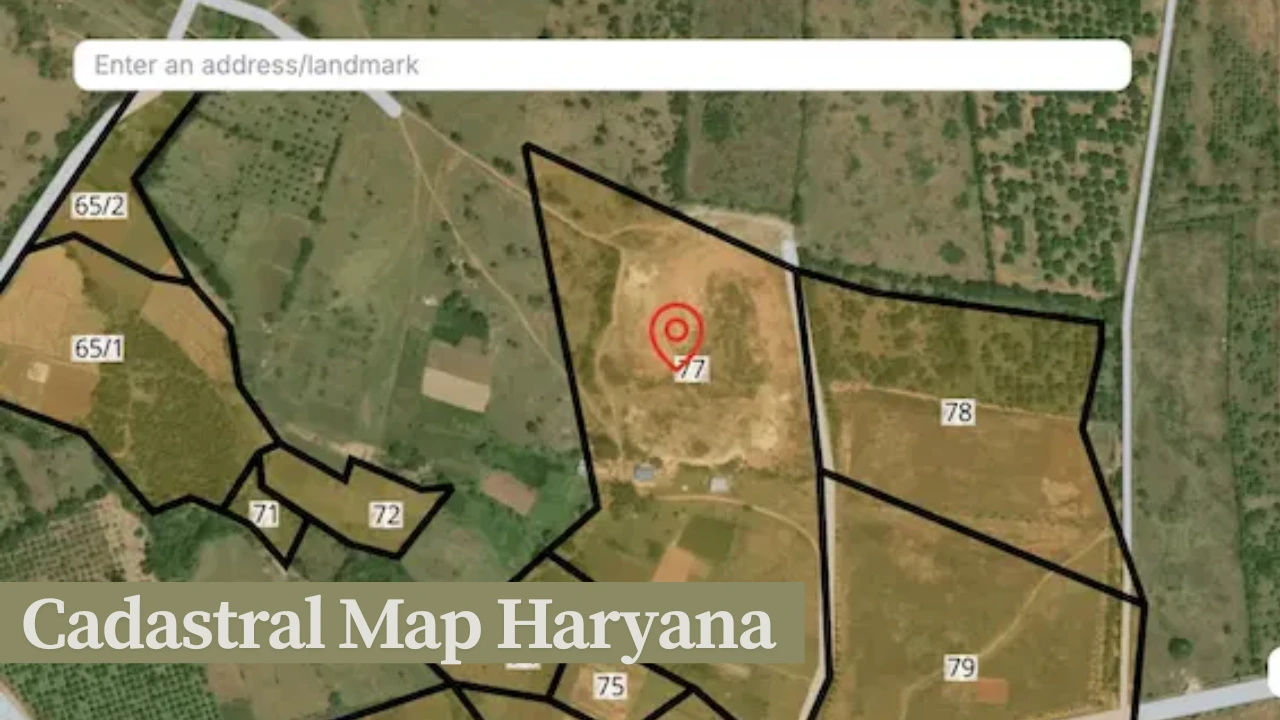
What Is Cadastral Map Haryana?
The cadastral map Haryana refers to digital land parcel maps that are linked with land ownership records. These maps are available through the Jamabandi portal and show the shape, size, and limits of land plots in any area across Haryana.
Land data visualisation is done using these maps. They are related to Khasra, Khewat, and Khatauni numbers. They are a form of public resource that can be found online and used for many purposes, such as legal or planning. The maps are used to verify the data and ensure the properties are authentic.
Why Is the Cadastral Map Haryana Useful?
The cadastral map Haryana system makes land access smooth, transparent, and fast. Before this system was available online, land records were hard to obtain and often unreliable. With this new platform, users can get accurate data without visiting government offices repeatedly.
The maps help in land sale and purchase, confirming ownership, and avoiding disputes. They are also useful for loan approvals, crop insurance, and land mutation processes. In short, the cadastral map serves as a trustworthy and official source for land records in Haryana.
Steps to View the Cadastral Map Online
To view your land map, follow these simple steps through the official Jamabandi portal. You will need some basic information about your land.
How to Access the Map:
| Step | Description |
| 1 | Visit the official Jamabandi portal. |
| 2 | Click on the “Cadastral Maps” section. |
| 3 | Choose your district, tehsil, village. |
| 4 | Enter your Khasra or Khewat number. |
| 5 | View or download the land map. |
Once the details are entered, the map of your land will be displayed. You can then print or save the file for future use.
Areas Covered Under Cadastral Map Haryana
Most districts in Haryana are already covered under the cadastral mapping system. The digital maps are updated regularly as new areas are added. Below is a list of districts where cadastral maps are available online.
Districts with Available Maps:
| District | Availability |
| Karnal | Yes |
| Gurugram | Yes |
| Hisar | Yes |
| Sirsa | Yes |
| Faridabad | Yes |
| Panchkula | Yes |
| Jind | Yes |
| Rewari | Yes |
These maps cover both urban and rural areas. If your village or plot is not available yet, you may revisit the site after a few days or contact your local Patwari.
How to Search a Land Map by Khasra Number?
Many users prefer to search the cadastral map Haryana using their Khasra number. This method offers faster and more specific results.
To search by Khasra number:
- Visit the Jamabandi Haryana portal.
- Go to the “View Cadastral Maps” section.
- Click on “Search by Khasra.”
- Enter your district, tehsil, village, and Khasra number.
- Click “View” to get your map.
Information Needed for Khasra Search
| Field | Sample Entry |
| District | Kurukshetra |
| Tehsil | Thanesar |
| Village | Jhansa |
| Murabba No. | 35 |
| Khasra No. | 154 |
Ensure all inputs are accurate to avoid errors during your search.
What Is Jamabandi Portal?
The Jamabandi portal is the official site for land records in Haryana. It includes ownership details, mutation status, and various property services. The cadastral map Haryana is an essential feature of this platform.
It connects visual maps with written records such as Jamabandi (ownership), Khatauni (family distribution), and Khewat (owner entry). Together, this makes the system comprehensive and transparent.
How to Correct Errors in Land Maps?
Sometimes, users find mistakes in the land boundaries or ownership data displayed in their maps. In such cases, corrections can be made through the proper procedure.
To correct errors in your cadastral map Haryana, follow these steps:
- Visit your local tehsildar office.
- Submit an application mentioning the error.
- Attach valid ID proof and ownership documents.
- Track your request online through the portal.
This process helps maintain the accuracy and reliability of the digital records.
How Does the Cadastral Map Help Farmers?
For farmers, the cadastral map Haryana is extremely beneficial. It helps confirm landholding details during loan applications and agricultural subsidy schemes.
Some advantages for farmers include:
- Easy access to land boundaries for irrigation planning.
- Faster approval of Kisan Credit Cards.
- Land authentication for crop insurance.
- Official records during land leasing or sharecropping.
This system also helps avoid disputes with neighboring landowners by showing clear plot divisions.
Importance in Real Estate and Property Sales
Real estate agents and property buyers now rely on cadastral map Haryana before completing deals. The map provides clear verification of ownership and land size.
Buyers can avoid fraud by checking the authenticity of property claims. Sellers can provide proof of ownership quickly. This makes transactions smoother and more secure.
The map can be downloaded and submitted as a legal document during property registrations or transfers.
How Banks Use Cadastral Maps for Loan Approval?
Banks need land verification when giving loans to farmers or landowners. The cadastral map Haryana helps confirm plot boundaries and ownership.
Benefits include:
- Avoidance of disputes during lending.
- Faster documentation process.
- Proof of land for agricultural and housing loans.
- Simplified approval of loan applications.
Printed maps are often submitted along with loan forms to financial institutions.
What Is FSC and How It Links to Land Records?
FSC stands for Family Smart Card. It includes your family data, income details, and linked land holdings.
FSC is often used for:
- Verifying land during scheme applications.
- Linking ration card eligibility.
- Submitting proof for housing or income schemes.
- Claiming crop insurance.
The data is verified against the cadastral map Haryana system to avoid duplication.
Civil Supplies Department and Land Verification
The Civil Supplies Department uses digital maps to cross-verify land claims during distribution of subsidies and other welfare benefits.
They use maps to:
- Confirm farmer eligibility.
- Match land ownership with ration card data.
- Detect multiple claims or fraud.
This linkage helps ensure fairness in government benefit distribution.
NFSA and Land Ownership Checks
Under the National Food Security Act (NFSA), land records are checked to decide eligibility for subsidized food. The cadastral map Haryana helps verify who qualifies.
Landless households, small farmers, and BPL families are verified using:
- Digital land records
- Ownership maps
- Income data from FSC
This avoids wrong distribution and ensures benefits reach genuine people.
Tips for Using the Jamabandi Portal Efficiently
For new users here are some easy ways to avoid making mistakes the next time you are checking maps:
- So keep your Khasra & Khewat numbers handy.
- It is always in your hand to check the spellings of your village and tehsil.
- (Use a desktop or laptop for clearer maps.)
- Print maps in pdf format for later use.
- Also, check the data again before printing.
And, you can also get help from your nearest CSC (Common Service Center).
The Future of Cadastral Map Haryana
The mapping is being upgraded to be more accurate and user-friendly by the government. Among those are several features in development:
- Drone-based mapping for exact measurement.
- Real-time updates after land transactions.
- Mobile apps for quick access.
- Integration with Aadhaar and mobile OTP login.
These changes will make the cadastral map Haryana even more reliable and easy to use.
Conclusion
The cadastral map Haryana has made land management simple and secure. It is no longer necessary to visit offices or depend on handwritten records. The map system brings transparency, saves time, and avoids disputes.
From farmers and property buyers to loan seekers and government departments, everyone can benefit from this service. If you own land in Haryana, use this tool today. It helps you stay informed, protected, and empowered.
For your next property task, let the cadastral map Haryana be your first step.
Read Our More Blogs..


Leave a Reply